From its inception, Melbourne has always been a city by the river.
The first buildings were constructed along the riverbank, around the intersections of King, Queen and Collins Streets at the Western end of the city. The northern bank of the Yarra was firm ground, but across the river the outlook was much less promising.
At the time of the city's founding, the south bank of the Yarra was swampy for much of the year and frequently flooded. Princes Bridge, first constructed out of wood in the 1840's, helped connect the city to Port Melbourne, and the land either side of the road was a marshy wasteland, little used beyond the occasional sporting contest.
But it was not entirely empty, as members of the local indigenous population lived south of the Yarra, and continued to do so after the arrival of European settlers. The two populations lived effectively alongside each other, separated by the river, during the first decade of Melbourne's existence.
 |
| A corroboree at Emerald Hill in the 1840s, drawn by early settler William Liardet. |
Like so many things about Melbourne, this would change with the discovery of gold in Victoria in 1851.
Victoria's gold rush bought a human tidal wave down upon the city, with the population of Melbourne climbing dramatically from an estimated 29 000 in 1850 to 123 000 just four years later. And this figure only records the number of people residing in the city, and so does not count the large numbers of transients temporarily staying there on their way to and from the diggings. As the city expanded, the local indigenous groups would be driven from the vicinity, losing their traditional lands in a short space of time.
All of the new European arrivals needed a place to stay, which the young city was quite unable to provide them. The fixed accommodation in Melbourne was limited and was quickly overwhelmed. And so the arriving thousands spilled over, quite naturally, into the nearest vacant land available; the south bank of the Yarra. A vast tent shanty, dubbed 'Canvas Town,' sprouted either side of Princes Bridge in the 1850's, providing short term housing to many of Melbourne's new residents.
 |
Lithograph of Canvas Town from the early 1850's.
Note the CBD skyline in the background. |
Canvas Town was well established enough to have fixed street names - usually named tongue in cheek after fine streets in London; Mayfair, The Strand etc - which was something that certain parts of the city proper had not yet gotten. Among the thousands of tents, industrious types could make a good living selling the new arrivals provisions, prospecting gear and grog. Canvas Town was to be many new Australians first experience of their adopted country.
 |
Another view of Canvas Town; a water colour by
Edmund Thomas, painted in 1854. |
But Canvas Town would only last for a few years.
As Melbourne boomed in the 1850s, new suburbs would provide proper accommodation for the city's new residents. And the city's expansion would also make land at close proximity to the CBD more valuable. In a short space of time, the tents of Canvas Town would be replaced as industry rapidly took over a long stretch of the waterfront. The land was drained and became home to brickworks, breweries and factories.
But once the last of the temporary residents had finally departed, parts of the land where Canvas Town had stood fell into disuse again.
To the east of St Kilda Road, the land was particularly prone to flooding and was left essentially unused until the 1890's, when the Yarra River was redirected (this dried out area was turned into parkland, Alexandra Gardens, which is still in use today). To the west of the road, the future site of the Arts Centre would sit vacant behind the burgeoning industrial zone on the riverbank, waiting for someone to put it to use.
Which would happen in the 1870s, with the arrival of a circus.
Circus' were big business in the 19th and early 20th centuries in Australia, as they were throughout much of the world. At a time when long distance travel was difficult and expensive, they gave a glimpse of the wider world, as well as providing a rare form of entertainment that was suitable for all ages. In 1877, a large American circus company, Cooper and Bailey's, pitched their tent next to St Kilda road for the first time.
 |
An elephant being unloaded for Cooper and Bailey's
first Australian circus, 1877. |
To maximise publicity for the show, the circus organised a procession through the city centre to the site, which caused a great deal of excitement (and became a tradition for visiting circus troupes around this time). The subsequent shows were such a success that Cooper and Bailey's came back every season for more then twenty years, through to 1900.
By this time, local troupes had appeared to rival the circus' from overseas, and a number of them had been eyeing off the prime location used by Cooper and Bailey's. One of Australia's largest homegrown circus', FitzGerald Brothers, successfully lobbied to take over the spot in 1901. The FitzGerald Brothers already had an association with Melbourne, having performed in the city since the early 1890's, but their previous site on Swanston Street had been lost to urban development. They took over the Yarra riverbank site with some optimism, even constructing a wooden theatre, the 'Olympia'.
But the FitzGerald's were soon displaced by the Wirth Brothers.
The Wirth Brothers circus had been known in Melbourne since the 1880's, when they appeared in the city to coincide with the Melbourne Cup. They spent more than a decade touring overseas, only returning to Melbourne permanently in 1907. Looking for a new home in the city and financially flush from their successful overseas stint, the Wirth's would buy out the FitzGerald's and take over their lucrative location.
 |
A Wirth Bros poster from 1907, the year
they returned to Melbourne. |
The Wirth Brothers would do things on an even grander scale than their predecessors. The 'Olympia' would be rebuilt both larger and in a more elaborate fashion and they would also add a hippodrome and an ice skating rink to the precinct. The new circus site was so successful that the Wirth's no longer needed to tour and so operated in Melbourne year round, turning their spot on the Yarra into one of the city's most popular attractions
.
 |
The 'Olympia' shortly after the Wirth's took over.
Note the elephant on the street out front. |
 |
| A map of the Wirth Circus in the early 20th century. |
Also around this time, there was wider redevelopment of the land around the circus. The Government established a small park, immediately adjacent to Princes Bridge and the waters edge, known as Snowden Gardens, which would remain for some seventy years. A small, tranquil spot surrounded by commercial buildings, it was fondly regarded by the city's residents.
 |
| The view from the top of Snowden Gardens in 1903, looking back towards the city. |
And next door to the Wirth Brothers, an amusement park came into being that added to the exotic appearance of the location. Built in 1904, 'Princes Court' featured a toboggan ride and water slide, as well as restaurants, bars and a Japanese tea house.
 |
| Princes Court, photographed in 1906. |
Although the Court would prove less successful than the circus, as it lasted only until 1908. The largely outdoor nature of the attractions, and Melbourne's cool climate, combined to make Princes Court a less viable option than the indoor circus.
 |
| Postcard for Princes Court |
But Wirth's success continued.
They expanded into the area vacated by Princes Court, building the 'Green Mill Dance Hall' there, and converted the Olympia into a cinema. During the First World War, some of the buildings in the sprawling complex were used for nursing veterans, and the dance hall was popular with returned serviceman.
 |
| A poster advertising the circus from 1921. |
The Great Depression would have an adverse effect on the circus, as it did on most forms of entertainment. A number of attractions would close during the 1930s, never to reopen. Although the dance hall, now called the 'Trocadero', remained popular, and would again prove a choice hangout for the returned servicemen of the Second World War.
 |
A Wirth's circus elephant at Spencer Street
station in the 1940's, helping to unload circus gear. |
But the grand age of the circus was over.
After World War Two, new types of entertainment, television chief among them, would begin to capture the public's attention, and circus' would find themselves more marginalised. The large size of the Wirth Brothers operation, and the costs associated with it, meant that any decrease in patronage made it difficult for them to continue. Although, in the end, the decision would be made for them.
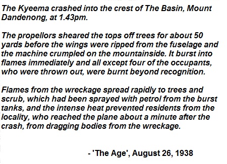
In 1953, most of the site was destroyed in a fire.
Flames were spotted coming from the main 'Olympia' building early on the morning of December 27 and the fire quickly spread. The Fairfax press takes up the story:
 |
| From the 'Sydney Morning Herald', December 28 1953. |
Rather than rebuild, the Wirth's decided to relinquish their long standing lease on the land. The site was purchased by the Victorian State Government, which seemed to solve a long standing problem in Victorian public life.
Since the 1940's, the State Government in Victoria had been looking for a location for a large cultural complex to house a gallery, theatres and a concert hall. The prime location of the Wirth Brother's spot meant that this had been a popular choice for these new institutions, but the Wirth's had an iron clad lock on the land which they were not, initially, interested in relinquishing. Once the fire encouraged them to fold their business, the State Government was ready to move in.
In 1955, Victorian Premier Henry Bolte announced that the old Wirth Brother's site would be home to a new Victorian Art's Centre. They appointed noted local architect Roy Grounds, who as a lad had spent some time acting on the 'Olympia' stage, to head the project.
Grounds' first proposal was for both the theatre and concert hall to be contained in one structure, and to be built underground, with an ornamental spire to mark the location on the surface. But the swampy, waterlogged history of the land would make this plan impractical. The ground was simply not stable enough to support such a large underground structure.
A revised plan then split the design into two separate buildings; a concert hall, to be known as Hamer Hall, on the riverbank and a performing arts centre, the Theatres Building, a short distance further along St Kilda Road. To support the shaky foundation for Hamer Hall, metal girders had to be sunk 25 metres into the bedrock below the construction site, and then electrified to prevent corrosion.
The complicated nature of the construction and the revisions required to the planning for the new buildings lead to extensive delays in the construction on the site. In the meantime, some of the land adjacent to St Kilda road was used as a large carpark. As part of the construction, Snowden Gardens was also added to the land under redevelopment
 |
Snowden Gardens in the 1960's. Flinders Street station
is visible across the river in the background. |
Commenced in 1973, nearly twenty years after they were first mandated, the Arts Centre would take ten further years to be built; Hamer Hall opening in 1982 and the Theatres Building in 1984.
 |
| Hamer Hall, a year after opening. |
After twenty years as an iconic landmark on Melbourne's south riverbank, Hamer Hall has been under renovation and redevelopment for the past two years. At a cost of $135 million dollars, the new Hamer Hall has been redesigned to link it more freely with the river's edge, and to try and make it more accessible to the general public. To this end, a new arcade of shops and restaurants has been added to the building. As a nod to the site's history, one of the new restaurants will be named the 'Trocadero.'
 |
| Artist's impression of the revised Hamer Hall. |
Whether this new development proves as popular with the city as the circus it replaced once was, remains to be seen. But certainly, this piece of land's long connection with Melbourne's arts and entertainment scene appears set to continue long into the future.